2016-12-29

Facilities อำนวยสะดวก

115 Island
เกาะ ๑๑๕
၁၁၅ ကျွန်း


2016-11-14  17:03

With its fresh water, a new resort has been under construction on the eastern island since 6 years ago. If it is finished, this will be the second resort in the Mergui Archipelago after Myanmar Andaman Resort on McCleod Island, excluded Thu Htay Island Hotel. There will be both the pier and helicoptor platform to serve the tourists here.

รีสอร์ตแห่งหนึ่งกำลังสร้างอยู่บนเกาะที่อยู่ทางตะวันออก เพราะเกาะนี้มีแหล่งน้ำจืด การก่อสร้างเริ่มมาได้ ๖ ปีแล้ว เมื่อแล้วเสร็จ รีสอร์ตแห่งนี้จะเป็นแห่งที่สองในหมู่เกาะมะริด ถัดจากเมียนมาอันดามันรีสอร์ตบนเกาะแมคคลาวด์ หากไม่รวมโรงแรมหรูที่เกาะตูเฐ โดยจะมีทั้งสะพานเทียบเรือและลานจอดเฮลิคอปเตอร์ให้บริการนักท่องเที่ยว


2016-12-25

115 Islands หมู่เกาะ ๑๑๕

115 Island
เกาะ ๑๑๕
၁၁၅ ကျွန်း


2016-11-14  17:25

Travellers often wonder why this island is called 115 ?

I have an answer from Ko Paing, 115 is the height in feet from sea level of the highest peak of this island.

นักท่องเที่ยวมักจะสงสัยว่า ทำไมเกาะนี้ถึงได้ชื่อว่า ๑๑๕ 

ผมได้คำตอบจากโกปายง์ว่า ๑๑๕ คือ ความสูงเป็นฟุตจากระดับน้ำทะเลของยอดที่สูงที่สุดของเกาะนี้

2016-12-22

Change เปลี่ยนแปลง

Poni Island
เกาะโพนี
ဖိုးနီကျွန်း


2016-11-14  16:40


The boat gets to the southern cape of Poni Island (Pocock Island in Wikimapia) when the cloudy sky pours down a heavy rain, only on us.

เรือถึงปลายแหลมด้านใต้ของเกาะโพนี (เกาะโปคอกในแผนที่วิกิแมเปีย) ฟ้าชุ่มน้ำก็เทฝนลงมาแบบไม่ทั่วฟ้า


2016-11-14  16:46

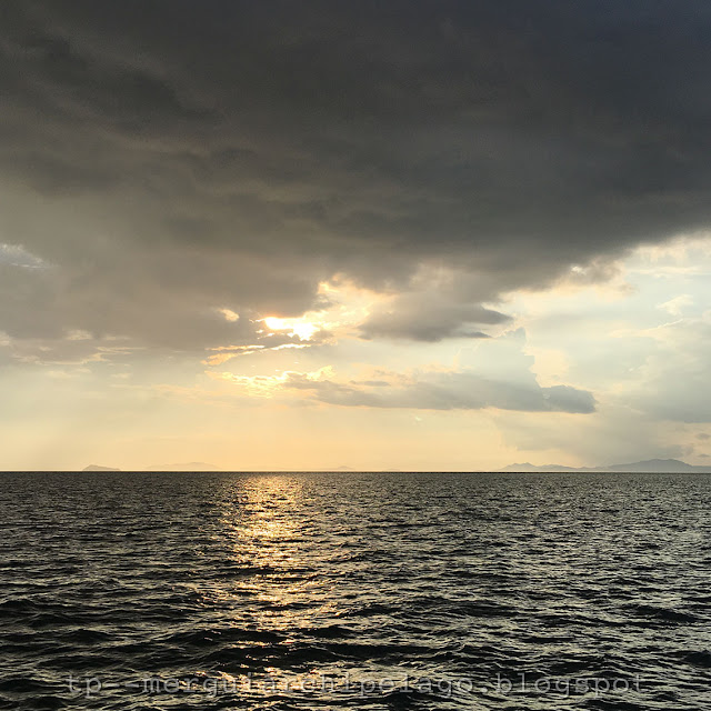
In less than ten minutes, the rain stops. The sun goes down below the black rain clouds, shining its golden ray on the western sky with Jar Lann Island in the distance.

ไม่ถึงสิบนาที ฝนก็หยุด ดวงอาทิตย์คล้อยต่ำพ้นเมฆฝนดำครึ้มมาได้ สาดแสงสีทองจับท้องฟ้าด้านตะวันตกโดยมีเกาะจะลาง์มองเห็นอยู่ลิบๆ


2016-12-18

Navigate นำทาง

Myauk La Bo Island
เกาะมเยาะอ์ละโพะ
မြောက်လဖို့ကျွန်း


2016-11-14  16:12

The boat aprroaches Myauk La Bo or the North Hump Island, seen as an isolate landmark on the right. From here, we can see a group of islands, large and small, in front. The 115 islands, our today destination, are among of them on the left end. The highest and largest Nyaung Wee Island is at the background.

พอเรือมาถึงเกาะมเยาะอ์ละโพะ ที่ผมขอเรียกเป็นภาษาไทยว่า เกาะหนอกเหนือ ซึ่งมองเห็นเป็นเกาะเดี่ยวทางขวามือ ตรงหน้าจะเห็นหมู่เกาะใหญ่น้อยกลุ่มใหญ่ หนึ่งในนั้นคือจุดหมายของเราวันนี้ หมู่เกาะ ๑๑๕ ที่มองเห็นอยู่ซ้ายมือสุด เกาะญอง์วีซึ่งใหญ่และสูงที่สุดอยู่ด้านหลัง


2016-11-14  16:26

Sailing through the islands, the experienced captain also needs navigator tools. In the captain's cabin, Ko Moe has both GPS and sonar. In the pictures above, our boat is passing Myauk La Bo Island on the right.

การเดินเรือผ่านหมู่เกาะ กัปตันที่มีประสบการณ์ก็ต้องอาศัยเครื่องมือช่วยนำทาง ในห้องกัปตันของโกโม มีทั้งระบบนำร่องและเครื่องจับความลึกของท้องน้ำ จากภาพข้างบน เรือกำลังผ่านเกาะมเยาะอ์ละโพะด้านขวามือ


2016-11-14  16:35

To know where to go is the first step of navigation.

จะนำทางได้ดี ต้องมีจุดหมายเสียก่อน

2016-12-15

Alive ชีวิตชีวา

Khunn Pya Gyi Island
เกาะจูง์ปยาจี
ကျွန်းပြားကြီးကျွန်း


2016-11-14  15:15


2016-11-14  15:32-15:43

I sit watching the colors gradually being painted on the feeling-blue clouds, then comes a rainbow. It slowly moves across a dreary Khunn Pya Gyi Island or the Big Flat Island. (Pine Tree Island in Wikimapia) the moment it gently touches the island's southern corner and a sandy beach there becomes bright white, it really makes this plain island and me become alive. 

นั่งมองแถบสีค่อยๆ ถูกระบายทาบทับก้อนเมฆสีหม่น ก่อนจะปรากฏเป็นรุ้งกินน้ำที่ขยับตัวเคลื่อนผ่านเกาะจูง์ปยาจี เกาะแบนๆ ซึ่งผมอยากจะเรียกแบบไทยๆ ว่า เกาะกระดานใหญ่ (เกาะสนในแผนที่วิกิแมเปีย) ที่แทบไม่มีอะไรน่าสนใจนี้ แต่พอปลายรุ้งแตะมุมเกาะด้านใต้ แล้วมองเห็นหาดทรายสีขาวสว่างโพลนขึ้น มันทำให้ทั้งเกาะและชีวิตเรียบๆ ของผมมีชีวิตชีวาขึ้นพลัน


2016-11-14  15:36

The rainbow or thet tan (သက်တံ) in Myanmar, its meaning implies life and breath.

รุ้งกินน้ำ หรือ แตะอ์ตาง์ 
(သက်တံ) ในภาษาเมียนมามีความหมายโยงถึง ชีวิตและลมหายใจ

2016-12-11

Pals สหาย

Ngar Lone Tan (Pyinsa Depa) Islands
เกาะงาโลง์ตาง์ (ปยีง์ซะเดปะ)
ငါးလုံးတန်းကျွန်း


2016-11-14  13:09

Not far from Taung La Bo Island to the east are 5 small islands initially seen as a group. The crew calls them Ngar Lone Tan Islands which can be translated as 'row of five' from their related position. The official name in the map is Pyinsa Depa Islands, words from Pali language which also mean five. It fosters my imagination of five close friends standing side by side as one in a boundless sea.

ทางตะวันออกของเกาะตอง์ละโพะไม่ไกลนัก มีเกาะเล็กๆ ๕ เกาะ ที่ตอนแรกมองเห็นเหมือนอยู่รวมกันเป็นกลุ่ม ชาวเรือเรียกชื่อตามลักษณะว่า เกาะงาโลง์ตาง์ แปลว่า เกาะเรียงห้า แต่มีชื่อเป็นทางการในแผนที่ว่า เกาะปยีง์ซะเดปะ เป็นคำเมียนมาที่ยืมมาจากบาลีเหมือนคำว่า ปัญจ หรือ เบญจ ของไทย ซึ่งแปลว่าห้าเหมือนกัน มันทำให้ผมจินตนาการถึงเพื่อนห้าคนที่รวมกลุ่ม
เป็นหนึ่งเดียวไม่ทิ้งกัน ท่ามกลางท้องทะเลเวิ้งว้าง


2016-11-14  14:56

When the boat sails further, I realize that these islands are not a group but a row from north to south as their name. When we change our position, we see the location and shape of the islands differently. The fact that ancient mariners knew how to navigate their vessels without the GPS.

เมื่อเรือแล่นผ่านไปอีกจุดหนึ่ง จึงเห็นว่า ความจริงแล้ว เกาะทั้งห้าไม่ได้อยู่กันเป็นกลุ่ม แต่เรียงตัวในแนวจากเหนือมาใต้ตรงตามชื่อ เราเห็นตำแหน่งและรูปทรงของเกาะแตกต่างไป เมื่อเรือของเราเปลี่ยนตำแหน่ง ความจริงที่นักเดินเรือแต่โบราณใช้เป็นหมายในการเดินทางโดยไม่ต้องพึ่งจีพีเอส


2016-11-14  15:42

Taung La Bo Island, Ngar Lone Tan Islands and the mainland. These islands are about 17 kilometres from the main land.

เกาะตอง์ละโพะ เกาะงาโลง์ตาง์ และแผ่นดินใหญ่ เกาะนี้อยู่ห่างจากแผ่นดินประมาณ​ ๑๗ กิโลเมตรเท่านั้น

2016-12-07

Recall ระลึก

Taung La Bo Island 
เกาะตอง์ละโพะ
တောင်လဖို့ကျွန်း


2016-11-14  13:16

After lunch on board for about an hour, I see our first stop in front, Taung La Bo Island. I ask the crew about its meaning, it would presumably be translated as the South Hump Island. There are 3 islands around here with the name La Bo which means ridge or hump, so they are South Hump, North Hump and Cow Hump Islands.

หลังอาหารเที่ยงมื้อแรกบนเรือได้ชั่วโมงกว่า ก็เห็นเกาะแรกที่เรือจะแวะอยู่ตรงหน้า เกาะตอง์ละโพะ ผมถามความหมายของชื่อจากลูกเรือ สันนิษฐานน่าจะแปลเป็นไทยได้ว่า เกาะหนอกใต้ เพราะแถวนี้มีเกาะที่ชื่อลงท้ายคล้ายๆ กัน คือ ละโพะ แปลว่า สัน ถม หรืออาจหมายถึงหนอก ก็จะมีเกาะหนอกใต้เกาะนี้ เกาะหนอกเหนือ และเกาะหนอกวัว 


2016-11-14  13:37


Then I spend over an hour later recall my memory in snorkelling here. Although I go to the sea every year, but mainly enjoy sitting and walking on the beach. I even can not remember my last time snorkelling, may be more than 10 years. Today is like a homecoming party, greeting Nemo the clownfish and sea anemone, hard corals and of course a gang of sea urchins.

ผมใช้เวลาตลอดชั่วโมงหลังจากนั้น ระลึก..ฟื้นความจำการดำน้ำตื้นที่นี่ เพราะถึงผมจะเที่ยวทะเลอยู่ทุกปี แต่ส่วนใหญ่ก็จะนั่งเล่นหรือเดินชายหาดเท่านั้น จำไม่ได้แล้วด้วยซ้ำว่าดำน้ำตื้นครั้งสุดท้ายแบบนี้เมื่อไร น่าจะเกิน ๑๐ ปี วันนี้เลยเหมือนการคืนสู่เหย้า ทักทายเจ้านีโม่ ปลาการ์ตูนกับซีแอนนีโมน ปะการังแข็ง แล้วเจ้าถิ่นอย่างเม่นทะเลอย่างคุ้นเคย


2016-11-14  15:14

2016-12-04

Shallow Deep ตื้น ลึก

Zar Det Gyi Islands, Zar Det Nge Islands
หมู่เกาะซาแดะอ์จี ซาแดะอ์แง
ဇာဒက်ကြီးကျွန်း၊ ဇာဒက်ငယ်ကျွန်း


2016-11-14  11:08

Beyond the northern tip of the last Salone Island on the left, the boat reaches an open sea. The next islands on the west, Za Det Gyi and Za Det Nge Islands or Big and Small Zar Det Islands, are seen as faded ranges in the distance. Looking around, I think it is really a deep blue sea.

พ้นปลายแหลมด้านเหนือของเกาะซะโลง์เกาะสุดท้ายที่เห็นทางซ้ายมือของภาพ เรือก็ออกสู่ทะเลใหญ่ เกาะถัดไปทางตะวันตก คือ หมู่เกาะซาแดะอ์จีและซาแตะอ์แงหรือซาแดะอ์ใหญ่กับเล็ก ก็ยังเห็นเป็นเพียงทิวอยู่ลิบๆ รอบตัวมองเห็นแต่ท้องน้ำสีครามเวิ้งว้าง ผมคิดว่าน้ำทะเลคงจะลึกมาก


2016-11-14  11:35


These set bag nets teach me "don't judge others superficially"

โพงพางพวกนี้สอนผมว่า "อย่ามองอะไรแค่ผิวๆ"