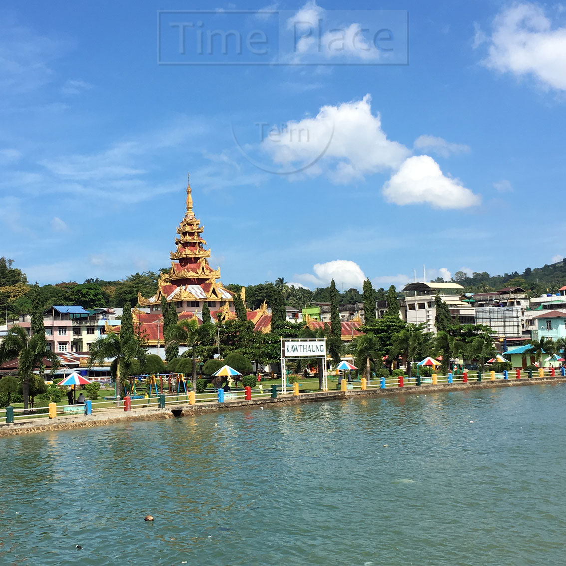
เกาะซะโลง์
ဆလုံကျွန်း

2016-11-14 10:55
Opposite Salone Island to the east, I have a better view of Southern Myanmar Peninsula. Kaw Thaung is seen as the foreground hill on the right. The mountains up north are in the middle, a small white spot (black arrow) in the center is Shwe Bone Shein (ရွှေဘုန်းရှိန်) pagoda built on the highest peak in that area. It was said that this pagoda was built by only one man, he worked alone from the beginning when no one believed in his attempt. Finally he finished it with his strong will.
ตรงข้ามกับเกาะซะโลง์ ถ้ามองไปทางทิศตะวันออก จะเห็นผืนแผ่นดินใหญ่สวนปลายสุดของเมียนมาชัดเจนขึ้น มองเห็นเกาะสองเป็นเนินเขาอยู่ขวามือด้านหน้าในรูป ตรงกลางคือเทือกเขาที่อยู่ทางเหนือขึ้นไป จุดเล็กๆ สึขาวบนยอดเขาตรงตำแหน่งลูกศรสีดำ คือ เจดีย์ของวัดชเวโบง์เชง์ (ရွှေဘုန်းရှိန်) ซึ่งสร้างอยู่บนยอดเขาที่สูงที่สุดในบริเวณนั้น เล่ากันว่า ผู้สร้างเจดีย์องค์นี้ทำงานอยู่คนเดียวในระยะแรก เพราะไม่มีใครเชื่อว่าจะทำสำเร็จ แต่สุดท้ายเขาก็สร้างได้จริงๆ ด้วยความมุ่งมั่น

I almost couldn't join this cruise from my misunderstanding. I thought Thais can visit Myanmar for 14 days without VISA. Two days before my trip, the tourist agency informed me that the VISA exemption can be applied only for those who entered the country via international airports. The Ranong - Kaw Thaung border pass also can be applied only for Kaw Thaung proximity. If I travelled beyond to Myeik Archipelago, I needed official VISA. Luckily the process to apply eVISA online took less than 24 hours. Finally I'm here, enjoy the strong wind.
ผมเกือบไม่ได้มาล่องเรือครั้งนี้แล้วด้วยความเข้าใจผิดว่า คนไทยมาเมียนมาได้โดยไม่ต้องใช้วีซ่า ๑๔ วัน แต่มารู้เอาจากบริษัททัวร์ก่อนออกเดินทางเพียง ๒ วันว่า กฏเกณฑ์นั้นใช้ได้เฉพาะการเข้าเมืองผ่านสนามบินนานาชาติเท่านั้น ส่วนการผ่านชายแดนระนอง-เกาะสองก็จำกัดระยะทางเฉพาะพื้นที่โดยรอบเกาะสองอีกเช่นกัน หากมาล่องเรือไกลถึงหมู่เกาะมะริดแบบนี้ต้องขอวีซ่าให้เรียบร้อย โชคดีที่การขอ eVisa ทางออกไลน์ใช้เวลาไม่ถึง ๒๔ ชม. ผมถึงได้มานั่งรับลมแรงๆ สมหวัง
Opposite Salone Island to the east, I have a better view of Southern Myanmar Peninsula. Kaw Thaung is seen as the foreground hill on the right. The mountains up north are in the middle, a small white spot (black arrow) in the center is Shwe Bone Shein (ရွှေဘုန်းရှိန်) pagoda built on the highest peak in that area. It was said that this pagoda was built by only one man, he worked alone from the beginning when no one believed in his attempt. Finally he finished it with his strong will.
ตรงข้ามกับเกาะซะโลง์ ถ้ามองไปทางทิศตะวันออก จะเห็นผืนแผ่นดินใหญ่สวนปลายสุดของเมียนมาชัดเจนขึ้น มองเห็นเกาะสองเป็นเนินเขาอยู่ขวามือด้านหน้าในรูป ตรงกลางคือเทือกเขาที่อยู่ทางเหนือขึ้นไป จุดเล็กๆ สึขาวบนยอดเขาตรงตำแหน่งลูกศรสีดำ คือ เจดีย์ของวัดชเวโบง์เชง์ (ရွှေဘုန်းရှိန်) ซึ่งสร้างอยู่บนยอดเขาที่สูงที่สุดในบริเวณนั้น เล่ากันว่า ผู้สร้างเจดีย์องค์นี้ทำงานอยู่คนเดียวในระยะแรก เพราะไม่มีใครเชื่อว่าจะทำสำเร็จ แต่สุดท้ายเขาก็สร้างได้จริงๆ ด้วยความมุ่งมั่น

ผมเกือบไม่ได้มาล่องเรือครั้งนี้แล้วด้วยความเข้าใจผิดว่า คนไทยมาเมียนมาได้โดยไม่ต้องใช้วีซ่า ๑๔ วัน แต่มารู้เอาจากบริษัททัวร์ก่อนออกเดินทางเพียง ๒ วันว่า กฏเกณฑ์นั้นใช้ได้เฉพาะการเข้าเมืองผ่านสนามบินนานาชาติเท่านั้น ส่วนการผ่านชายแดนระนอง-เกาะสองก็จำกัดระยะทางเฉพาะพื้นที่โดยรอบเกาะสองอีกเช่นกัน หากมาล่องเรือไกลถึงหมู่เกาะมะริดแบบนี้ต้องขอวีซ่าให้เรียบร้อย โชคดีที่การขอ eVisa ทางออกไลน์ใช้เวลาไม่ถึง ๒๔ ชม. ผมถึงได้มานั่งรับลมแรงๆ สมหวัง