2016-12-29

Facilities อำนวยสะดวก

115 Island
เกาะ ๑๑๕
၁၁၅ ကျွန်း


2016-11-14  17:03

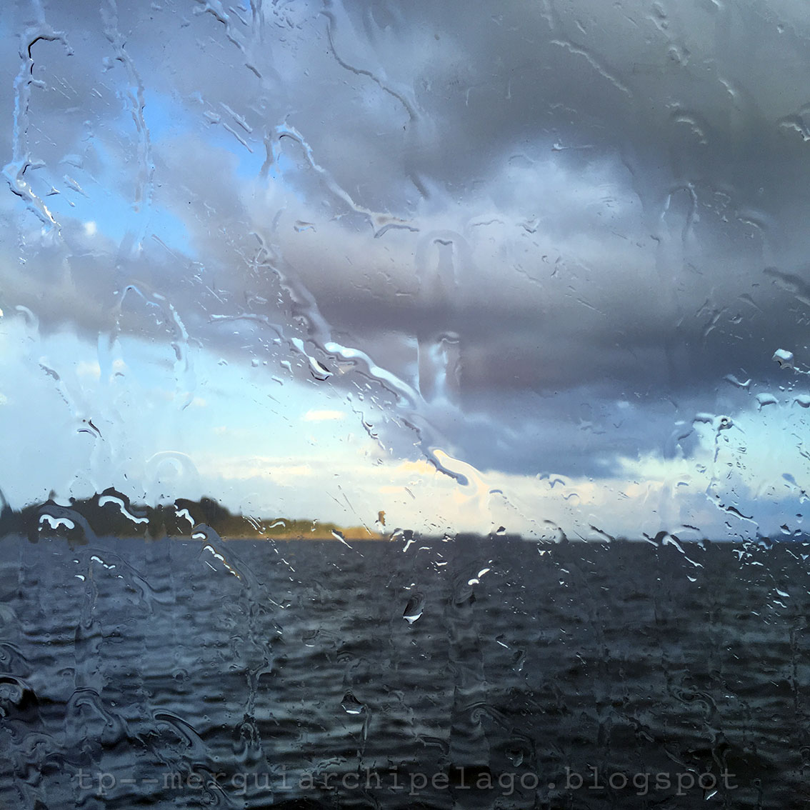
With its fresh water, a new resort has been under construction on the eastern island since 6 years ago. If it is finished, this will be the second resort in the Mergui Archipelago after Myanmar Andaman Resort on McCleod Island, excluded Thu Htay Island Hotel. There will be both the pier and helicoptor platform to serve the tourists here.

รีสอร์ตแห่งหนึ่งกำลังสร้างอยู่บนเกาะที่อยู่ทางตะวันออก เพราะเกาะนี้มีแหล่งน้ำจืด การก่อสร้างเริ่มมาได้ ๖ ปีแล้ว เมื่อแล้วเสร็จ รีสอร์ตแห่งนี้จะเป็นแห่งที่สองในหมู่เกาะมะริด ถัดจากเมียนมาอันดามันรีสอร์ตบนเกาะแมคคลาวด์ หากไม่รวมโรงแรมหรูที่เกาะตูเฐ โดยจะมีทั้งสะพานเทียบเรือและลานจอดเฮลิคอปเตอร์ให้บริการนักท่องเที่ยว


2016-12-25

115 Islands หมู่เกาะ ๑๑๕

115 Island
เกาะ ๑๑๕
၁၁၅ ကျွန်း


2016-11-14  17:25

Travellers often wonder why this island is called 115 ?

I have an answer from Ko Paing, 115 is the height in feet from sea level of the highest peak of this island.

นักท่องเที่ยวมักจะสงสัยว่า ทำไมเกาะนี้ถึงได้ชื่อว่า ๑๑๕ 

ผมได้คำตอบจากโกปายง์ว่า ๑๑๕ คือ ความสูงเป็นฟุตจากระดับน้ำทะเลของยอดที่สูงที่สุดของเกาะนี้

2016-12-22

Change เปลี่ยนแปลง

Poni Island
เกาะโพนี
ဖိုးနီကျွန်း


2016-11-14  16:40


The boat gets to the southern cape of Poni Island (Pocock Island in Wikimapia) when the cloudy sky pours down a heavy rain, only on us.

เรือถึงปลายแหลมด้านใต้ของเกาะโพนี (เกาะโปคอกในแผนที่วิกิแมเปีย) ฟ้าชุ่มน้ำก็เทฝนลงมาแบบไม่ทั่วฟ้า


2016-11-14  16:46

In less than ten minutes, the rain stops. The sun goes down below the black rain clouds, shining its golden ray on the western sky with Jar Lann Island in the distance.

ไม่ถึงสิบนาที ฝนก็หยุด ดวงอาทิตย์คล้อยต่ำพ้นเมฆฝนดำครึ้มมาได้ สาดแสงสีทองจับท้องฟ้าด้านตะวันตกโดยมีเกาะจะลาง์มองเห็นอยู่ลิบๆ


2016-12-18

Navigate นำทาง

Myauk La Bo Island
เกาะมเยาะอ์ละโพะ
မြောက်လဖို့ကျွန်း


2016-11-14  16:12

The boat aprroaches Myauk La Bo or the North Hump Island, seen as an isolate landmark on the right. From here, we can see a group of islands, large and small, in front. The 115 islands, our today destination, are among of them on the left end. The highest and largest Nyaung Wee Island is at the background.

พอเรือมาถึงเกาะมเยาะอ์ละโพะ ที่ผมขอเรียกเป็นภาษาไทยว่า เกาะหนอกเหนือ ซึ่งมองเห็นเป็นเกาะเดี่ยวทางขวามือ ตรงหน้าจะเห็นหมู่เกาะใหญ่น้อยกลุ่มใหญ่ หนึ่งในนั้นคือจุดหมายของเราวันนี้ หมู่เกาะ ๑๑๕ ที่มองเห็นอยู่ซ้ายมือสุด เกาะญอง์วีซึ่งใหญ่และสูงที่สุดอยู่ด้านหลัง


2016-11-14  16:26

Sailing through the islands, the experienced captain also needs navigator tools. In the captain's cabin, Ko Moe has both GPS and sonar. In the pictures above, our boat is passing Myauk La Bo Island on the right.

การเดินเรือผ่านหมู่เกาะ กัปตันที่มีประสบการณ์ก็ต้องอาศัยเครื่องมือช่วยนำทาง ในห้องกัปตันของโกโม มีทั้งระบบนำร่องและเครื่องจับความลึกของท้องน้ำ จากภาพข้างบน เรือกำลังผ่านเกาะมเยาะอ์ละโพะด้านขวามือ


2016-11-14  16:35

To know where to go is the first step of navigation.

จะนำทางได้ดี ต้องมีจุดหมายเสียก่อน

2016-12-15

Alive ชีวิตชีวา

Khunn Pya Gyi Island
เกาะจูง์ปยาจี
ကျွန်းပြားကြီးကျွန်း


2016-11-14  15:15


2016-11-14  15:32-15:43

I sit watching the colors gradually being painted on the feeling-blue clouds, then comes a rainbow. It slowly moves across a dreary Khunn Pya Gyi Island or the Big Flat Island. (Pine Tree Island in Wikimapia) the moment it gently touches the island's southern corner and a sandy beach there becomes bright white, it really makes this plain island and me become alive. 

นั่งมองแถบสีค่อยๆ ถูกระบายทาบทับก้อนเมฆสีหม่น ก่อนจะปรากฏเป็นรุ้งกินน้ำที่ขยับตัวเคลื่อนผ่านเกาะจูง์ปยาจี เกาะแบนๆ ซึ่งผมอยากจะเรียกแบบไทยๆ ว่า เกาะกระดานใหญ่ (เกาะสนในแผนที่วิกิแมเปีย) ที่แทบไม่มีอะไรน่าสนใจนี้ แต่พอปลายรุ้งแตะมุมเกาะด้านใต้ แล้วมองเห็นหาดทรายสีขาวสว่างโพลนขึ้น มันทำให้ทั้งเกาะและชีวิตเรียบๆ ของผมมีชีวิตชีวาขึ้นพลัน


2016-11-14  15:36

The rainbow or thet tan (သက်တံ) in Myanmar, its meaning implies life and breath.

รุ้งกินน้ำ หรือ แตะอ์ตาง์ 
(သက်တံ) ในภาษาเมียนมามีความหมายโยงถึง ชีวิตและลมหายใจ

2016-12-11

Pals สหาย

Ngar Lone Tan (Pyinsa Depa) Islands
เกาะงาโลง์ตาง์ (ปยีง์ซะเดปะ)
ငါးလုံးတန်းကျွန်း


2016-11-14  13:09

Not far from Taung La Bo Island to the east are 5 small islands initially seen as a group. The crew calls them Ngar Lone Tan Islands which can be translated as 'row of five' from their related position. The official name in the map is Pyinsa Depa Islands, words from Pali language which also mean five. It fosters my imagination of five close friends standing side by side as one in a boundless sea.

ทางตะวันออกของเกาะตอง์ละโพะไม่ไกลนัก มีเกาะเล็กๆ ๕ เกาะ ที่ตอนแรกมองเห็นเหมือนอยู่รวมกันเป็นกลุ่ม ชาวเรือเรียกชื่อตามลักษณะว่า เกาะงาโลง์ตาง์ แปลว่า เกาะเรียงห้า แต่มีชื่อเป็นทางการในแผนที่ว่า เกาะปยีง์ซะเดปะ เป็นคำเมียนมาที่ยืมมาจากบาลีเหมือนคำว่า ปัญจ หรือ เบญจ ของไทย ซึ่งแปลว่าห้าเหมือนกัน มันทำให้ผมจินตนาการถึงเพื่อนห้าคนที่รวมกลุ่ม
เป็นหนึ่งเดียวไม่ทิ้งกัน ท่ามกลางท้องทะเลเวิ้งว้าง


2016-11-14  14:56

When the boat sails further, I realize that these islands are not a group but a row from north to south as their name. When we change our position, we see the location and shape of the islands differently. The fact that ancient mariners knew how to navigate their vessels without the GPS.

เมื่อเรือแล่นผ่านไปอีกจุดหนึ่ง จึงเห็นว่า ความจริงแล้ว เกาะทั้งห้าไม่ได้อยู่กันเป็นกลุ่ม แต่เรียงตัวในแนวจากเหนือมาใต้ตรงตามชื่อ เราเห็นตำแหน่งและรูปทรงของเกาะแตกต่างไป เมื่อเรือของเราเปลี่ยนตำแหน่ง ความจริงที่นักเดินเรือแต่โบราณใช้เป็นหมายในการเดินทางโดยไม่ต้องพึ่งจีพีเอส


2016-11-14  15:42

Taung La Bo Island, Ngar Lone Tan Islands and the mainland. These islands are about 17 kilometres from the main land.

เกาะตอง์ละโพะ เกาะงาโลง์ตาง์ และแผ่นดินใหญ่ เกาะนี้อยู่ห่างจากแผ่นดินประมาณ​ ๑๗ กิโลเมตรเท่านั้น

2016-12-07

Recall ระลึก

Taung La Bo Island 
เกาะตอง์ละโพะ
တောင်လဖို့ကျွန်း


2016-11-14  13:16

After lunch on board for about an hour, I see our first stop in front, Taung La Bo Island. I ask the crew about its meaning, it would presumably be translated as the South Hump Island. There are 3 islands around here with the name La Bo which means ridge or hump, so they are South Hump, North Hump and Cow Hump Islands.

หลังอาหารเที่ยงมื้อแรกบนเรือได้ชั่วโมงกว่า ก็เห็นเกาะแรกที่เรือจะแวะอยู่ตรงหน้า เกาะตอง์ละโพะ ผมถามความหมายของชื่อจากลูกเรือ สันนิษฐานน่าจะแปลเป็นไทยได้ว่า เกาะหนอกใต้ เพราะแถวนี้มีเกาะที่ชื่อลงท้ายคล้ายๆ กัน คือ ละโพะ แปลว่า สัน ถม หรืออาจหมายถึงหนอก ก็จะมีเกาะหนอกใต้เกาะนี้ เกาะหนอกเหนือ และเกาะหนอกวัว 


2016-11-14  13:37


Then I spend over an hour later recall my memory in snorkelling here. Although I go to the sea every year, but mainly enjoy sitting and walking on the beach. I even can not remember my last time snorkelling, may be more than 10 years. Today is like a homecoming party, greeting Nemo the clownfish and sea anemone, hard corals and of course a gang of sea urchins.

ผมใช้เวลาตลอดชั่วโมงหลังจากนั้น ระลึก..ฟื้นความจำการดำน้ำตื้นที่นี่ เพราะถึงผมจะเที่ยวทะเลอยู่ทุกปี แต่ส่วนใหญ่ก็จะนั่งเล่นหรือเดินชายหาดเท่านั้น จำไม่ได้แล้วด้วยซ้ำว่าดำน้ำตื้นครั้งสุดท้ายแบบนี้เมื่อไร น่าจะเกิน ๑๐ ปี วันนี้เลยเหมือนการคืนสู่เหย้า ทักทายเจ้านีโม่ ปลาการ์ตูนกับซีแอนนีโมน ปะการังแข็ง แล้วเจ้าถิ่นอย่างเม่นทะเลอย่างคุ้นเคย


2016-11-14  15:14

2016-12-04

Shallow Deep ตื้น ลึก

Zar Det Gyi Islands, Zar Det Nge Islands
หมู่เกาะซาแดะอ์จี ซาแดะอ์แง
ဇာဒက်ကြီးကျွန်း၊ ဇာဒက်ငယ်ကျွန်း


2016-11-14  11:08

Beyond the northern tip of the last Salone Island on the left, the boat reaches an open sea. The next islands on the west, Za Det Gyi and Za Det Nge Islands or Big and Small Zar Det Islands, are seen as faded ranges in the distance. Looking around, I think it is really a deep blue sea.

พ้นปลายแหลมด้านเหนือของเกาะซะโลง์เกาะสุดท้ายที่เห็นทางซ้ายมือของภาพ เรือก็ออกสู่ทะเลใหญ่ เกาะถัดไปทางตะวันตก คือ หมู่เกาะซาแดะอ์จีและซาแตะอ์แงหรือซาแดะอ์ใหญ่กับเล็ก ก็ยังเห็นเป็นเพียงทิวอยู่ลิบๆ รอบตัวมองเห็นแต่ท้องน้ำสีครามเวิ้งว้าง ผมคิดว่าน้ำทะเลคงจะลึกมาก


2016-11-14  11:35


These set bag nets teach me "don't judge others superficially"

โพงพางพวกนี้สอนผมว่า "อย่ามองอะไรแค่ผิวๆ"

2016-11-30

Strong Will มุ่งมั่น

Salone Islands
เกาะซะโลง์
ဆလုံကျွန်း


2016-11-14  10:55

Opposite Salone Island to the east, I have a better view of Southern Myanmar Peninsula. Kaw Thaung is seen as the foreground hill on the right. The mountains up north are in the middle, a small white spot (black arrow) in the center is Shwe Bone Shein (ရွှေဘုန်းရှိန်) pagoda built on the highest peak in that area. It was said that this pagoda was built by only one man, he worked alone from the beginning when no one believed in his attempt. Finally he finished it with his strong will. 

ตรงข้ามกับเกาะซะโลง์ ถ้ามองไปทางทิศตะวันออก จะเห็นผืนแผ่นดินใหญ่สวนปลายสุดของเมียนมาชัดเจนขึ้น มองเห็นเกาะสองเป็นเนินเขาอยู่ขวามือด้านหน้าในรูป ตรงกลางคือเทือกเขาที่อยู่ทางเหนือขึ้นไป จุดเล็กๆ สึขาวบนยอดเขาตรงตำแหน่งลูกศรสีดำ คือ เจดีย์ของวัดชเวโบง์เชง์ (ရွှေဘုန်းရှိန်) ซึ่งสร้างอยู่บนยอดเขาที่สูงที่สุดในบริเวณนั้น เล่ากันว่า ผู้สร้างเจดีย์องค์นี้ทำงานอยู่คนเดียวในระยะแรก เพราะไม่มีใครเชื่อว่าจะทำสำเร็จ แต่สุดท้ายเขาก็สร้างได้จริงๆ ด้วยความมุ่งมั่น


I almost couldn't join this cruise from my misunderstanding. I thought Thais can visit Myanmar for 14 days without VISA. Two days before my trip, the tourist agency informed me that the VISA exemption can be applied only for those who entered the country via international airports. The Ranong - Kaw Thaung border pass also can be applied only for Kaw Thaung proximity. If I travelled beyond to Myeik Archipelago, I needed official VISA. Luckily the process to apply eVISA online took less than 24 hours. Finally I'm here, enjoy the strong wind.

ผมเกือบไม่ได้มาล่องเรือครั้งนี้แล้วด้วยความเข้าใจผิดว่า คนไทยมาเมียนมาได้โดยไม่ต้องใช้วีซ่า ๑๔ วัน แต่มารู้เอาจากบริษัททัวร์ก่อนออกเดินทางเพียง ๒ วันว่า กฏเกณฑ์นั้นใช้ได้เฉพาะการเข้าเมืองผ่านสนามบินนานาชาติเท่านั้น ส่วนการผ่านชายแดนระนอง-เกาะสองก็จำกัดระยะทางเฉพาะพื้นที่โดยรอบเกาะสองอีกเช่นกัน หากมาล่องเรือไกลถึงหมู่เกาะมะริดแบบนี้ต้องขอวีซ่าให้เรียบร้อย โชคดีที่การขอ eVisa ทางออกไลน์ใช้เวลาไม่ถึง ๒๔ ชม. ผมถึงได้มานั่งรับลมแรงๆ สมหวัง

2016-11-29

Foreigner แขก

Kalar Island, Salone Islands
เกาะกะลา เกาะซะโลง์
ကုလားကျွန်း၊ ဆလုံကျွန်း


2016-11-14  10:50

Three islands on the west of Kaw Thaung are grouped and called Salone Islands, the name Myanmar people called the Moken people or sea gypsy. The small south island with the lighthouse in this picture is call Kalar Island. Kalar (written Kular), the name Myanmar people called foreigners especially those from India.

เกาะ ๓ เกาะที่อยู่ทางตะวันตกของเกาะสองถูกเรียกรวมๆ กันว่า เกาะซะโลง์ หรือ เกาะชาวเล เพราะคำว่า ซะโลง์ เป็นคำที่ชาวเมียนมาเรียกชาวเลมอแกน เกาะเล็กที่อยู่ทางใต้สุด ซึ่งมีประภาคารตั้งอยู่ ชื่อว่า เกาะกะลา (เขียนว่า กุลา) คำที่ชาวเมียนมาเรียกคนต่างชาติ โดยเฉพาะที่มาจากอินเดีย


2016-11-14  10:49

Salone Kyunn Gyi Island, the biggest of the three in the middle, had a Buddhist temple on the hill top. This implies that there are not just Salone people on these islands.

เกาะซะโลง์จูง์จี หรือ เกาะใหญ่ เกาะใหญ่ที่สุดตรงกลางใน ๓ เกาะ มีเจดีย์ตั้งอยู่บนยอดเขา บอกให้รู้ว่า ไม่ได้มีแต่ชาวเลเท่านั้นที่อยู่บนเกาะเหล่านี้แล้ว


(Salone Islands from Kaw Thaung)

These island names recall me a Thai word "Kalar or Kular" that usually describes "ugly dirty lady servant" in the folktale, a word of negative expression.

ชื่อเกาะเหล่านี้ทำให้ผมนึกถึงคำว่า "กะลา หรือ กุลา" ในภาษาไทย ซึ่งมักใช้บรรยาย "นางกุลา คนรับใช้รูปชั่วตัวดำ" ในนิทานพื้นบ้าน คำที่มีความหมายเชิงดูหมิ่นดูแคลน

2016-11-28

Rich Man's Island เกาะเศรษฐี

Thu Htay (Tha Htay) Island
เกาะตูเฐ (ตะเฐ) 
သူဌေးကျွန်း


2016-11-14  06:44
(from Pyi Daw Aye Temple, Kaw Thaung)

Beyond Kaw Thaung to the south on the same range is an island locally called Thu Htay or Tha Htay Island. Literally it means the rich man's island.

The name says it all. The single island which is different from any others in Mergui Archipelago with five-star hotel and a casino for another class of people.

ถัดจากเกาะสองไปทางใต้นิดเดียว มีเกาะใหญ่ที่ตั้งอยู่ในแนวเดียวกัน มีชื่อที่คนแถวนั้นเรียกว่า เกาะตูเฐ หรือ ตะเฐ แปลว่า เกาะคนรวย หรือ เกาะเศรษฐี

แค่ชื่อก็รู้แล้ว ไม่ต้องอธิบายมากสำหรับเกาะๆ นี้ ซึ่งแตกต่างจากทุกเกาะในหมู่เกาะมะริด โรงแรมระดับห้าดาวและคาสิโน สำหรับคนอีกระดับที่แตกต่างไป


2016-11-14  10:42

Just passes the northwest cape of Thu Htay island in the left foreground of this picture,  many islands are visible if looking southward. The big one at the background is Chang Island, the northernmost large island in neighboring Thailand.

พอพ้นปลายแหลมด้านตะวันตกเฉียงเหนือของเกาะตูเฐที่อยู่ข้างหน้าด้านซ้ายในภาพ หากมองลงใต้ จะเห็นเกาะมากมาย เกาะใหญ่ที่มองเห็นอยู่ด้านหลัง คือ เกาะช้าง เกาะใหญ่ที่อยู่เหนือสุดในเขตประเทศไทย

2016-11-27

It's not an Island ไม่ใช่เกาะ

Kaw Thaung
เกาะสอง
ကော့သောင်း


2016-11-14  10:13


The beginning of this journey is at Kaw Thaung or the second island, a confusing name in Thai. Actually it's not an island, but the southernmost tip of Myanmar mainland.

จุดเริ่มต้นของการเดินทางครั้งนี้ คือ เกาะสอง ชื่อไทยที่ทำให้สับสน ที่นี่เป็นผืนแผ่นดินใหญ่ ปลายคาบสมุทรทางใต้สุดของเมียนมา


2016-11-14  10:16

The jetty is on the east side of the town. The boat has to move around the southernmost tip known in Myanmar as Bayinnaung Point or Cape, then goes on westward to the Andaman Sea.

จากท่าเรือที่อยู่ฝั่งตะวันออกของเมือง เรือต้องขับอ้อมปลายแหลมด้านใต้สุดที่ชาวเมียนมาเรียกว่า แหลมบุเรงนอง ซึ่งเป็นสวนสาธารณะบนเนินเขา ออกสู่ทะเลอันดามันฝั่งตะวันตก 


2016-11-14  10:17


Location of a flagpole on the hill top is King Bayinnaung Statue site.

ที่ตั้งของเสาธงบนเนินเขาที่เห็นนั้น คือ ตำแหน่งอนุสาวรีย์พระเจ้าบุเรงนอง

2016-11-23

Nature Sculpture ประติมากรรมธรรมชาติ

115 Islands
หมู่เกาะ ๑๑๕
၁၁၅ ကျွန်းစု


2016-11-15  08:37


2016-11-15  08:38


2016-11-15  08:38


2016-11-15  08:39


2016-11-15  08:40

This small brook flows directly into the sea in front of the north beach. Here is a confluence of hard pebbles, soft sand and running water which creates the ornate sculptures that are continuously being changed by time and tide.

ลำธารเล็กๆ สายนี้ไหลลงสู่ทะเลตรงหน้าหาดทรายด้านเหนือของกาะหนึ่ง จึงเป็นจุดบรรจบของก้อนกรวดแข็ง ผืนทรายละเอียดและสายน้ำริน เกิดเป็นงานประติมากรรมอันวิจิตร ที่แปรเปลี่ยนอยู่ตลอดเวลาตามจังหวะน้ำขึ้นน้ำลง

Sea Grass หญ้าทะเล

Thay Yae Island, Zar Det Nge Islands
เกาะเตเย หมู่เกาะซาแดะอ์แง
သေရည်ကျွန်း၊ ဇာဒက်ငယ်ကျွန်း


2016-11-18  09:43

Despite being a busy channel with a deep passage and good shelters for small and large boats, around Thay Yae Island is rich with beautiful coral reefs and sea grass beds.

Really miss you, dugong.. my mermaids.

แม้จะเป็นช่องแคบที่มีการจราจรค่อนข้างคับคั่ง เพราะมีร่องน้ำลึกและมีจุดจอดเรือหลบคลื่นลมได้ทั้งเรือเล็กเรือใหญ่ แต่โดยรอบเกาะเตเยนี้ นอกจากจะมีจุดดำน้ำตื้นที่งดงามแล้ว ยังเป็นแหล่งหญ้าทะเลที่ยังอุดมสมบูรณ์อีกด้วย

คิดถึงเงือกสาว ..พะยูนสักตัว

Super Moon จันทร์เจ้า

115 Islands
หมู่เกาะ ๑๑๕
၁၁၅ ကျွန်းစု


2016-11-14  17:40

One reason that brings me here is this Super Moon.

I sit watching the eastern horizon with 115 islands in the foreground on the upper boat deck with expectation. After ensure that the tiny little spot at the corner of the island is not just a small white cloud as in the first picture, I reach my tripod and climb up the roof-top deck above Captain's cabin, followed by other travelers.

เหตุผลหนึ่งที่ผมเลือกมาหมู่เกาะมะริดช่วงนี้ คือ สิ่งนี้

ผมนั่งเฝ้ามองขอบฟ้าทิศตะวันออกที่มีหมู่เกาะ ๑๑๕ เป็นฉากหน้านี้อยู่บนดาดฟ้าห้องโดยสารเรืออย่างใจจดใจจ่อ แล้วเมื่อมั่นใจว่าจุดเล็กๆ ตรงมุมเกาะนั้นไม่ใช่เมฆสีขาวก้อนน้อยๆ ตามภาพแรก ผมก็รีบคว้าขาตั้งกล้อง แล้วปีนดาดฟ้าด้านบนห้องกัปตันที่ไม่มีหลังคาบัง โดยมีนักท่องเที่ยวคนอื่นกรูตามกันขึ้นมา


2016-11-14  18:27

We sit watching the moon for an hour. A spectacular full moon, so beautiful that it can not be literally described or recorded by my iPhone 6S+.

เรานั่งเฝ้ามองพระจันทร์ดวงนี้ทั้งชั่วโมง จันทร์เพ็ญที่งดงามนัก เกินกว่าที่จะบรรยายออกมาเป็นตัวอักษรหรือภาพถ่ายจากกล้อง iPhone 6S+ ได้

Always Together, Eternally Apart เคียงคู่ตลอดไป ร้างไกลนิรันดร

Lampi (Kyunn Tann Shey) Island
เกาะลาง์ปิ (จูง์ตาง์เช)
လန်ပိကျွန်း (ကျွန်းတန်းရှည်)


 2016-11-16  06:03

Waking up to witness a short moment that a couple .. sun and moon, which are "always together, eternally apart" can share the same sky.

This reminds me of the curse in the film 'Lady Hawke'. The Lady was transformed into a hawk during the day, while her lover, a knight, became a wolf during the night. Both could never be together as humans besides a short moment like this.

ตื่นขึ้นมาเฝ้าดูพระอาทิตย์และพระจันทร์ สองสิ่งที่ "เคียงคู่ตลอดไป ร้างไกลนิรันดร" ได้มีเวลาอยู่ร่วมฟ้าเดียวกัน แม้จะเป็นเพียงช่วงเวลาสั้นๆ ก็ตาม 

ทำให้นึกถึงคำสาปในภาพยนตร์เรื่อง 'เลดี้ฮอร์ค' ที่เจ้าหญิงต้องกลายเป็นเหยี่ยวในเวลากลางวัน ส่วนอัศวินคู่รักก็ต้องกลายเป็นหมาป่าในเวลากลางคืน ทั้งคู่ไม่มีโอกาสได้พบกันแบบมนุษย์เลย ยกเว้นช่วงเวลาสั้นๆ แบบนี้

2016-11-21

Treasure Island เกาะมหาสมบัติ

Shwe Kyunn Gyi Island
เกาะชเวจูง์จี
ရွှေကျွန်းကြီးကျွန်း


 2016-11-17 15:10


2016-11-17 15:04


Big Gold Island, its name may guide our imagination to Treasure Island. There had been gold mines on the island since the Second World War by the Japanese Army, but mining caused damage to the marine environment. Currently, the concession is granted for the pearl farms.

Walking along the northeast beach, I spot this hidden treasure.


เกาะทองใหญ่.. ได้ยินชื่อเกาะแล้ว ชวนให้จินตนาการถึงเกาะมหาสมบัติ และเกาะนี้เคยมีการทำเหมืองทองคำมาตั้งแต่สมัยสงครามโลกครั้งที่ 2 โดยกองทัพญี่ปุ่น แต่การทำเหมืองทำให้สภาพแวดล้อมทางทะเลเสียหายมาก ปัจจุบันจึงมีแต่สัมปทานเพาะเลี้ยงหอยมุก

เดินตามชายหาดด้านตะวันออกเฉียงเหนือ ผมมาพบขุมทรัพย์มูลค่ามหาศาลที่ซุกซ่อนอยู่ อย่างในรูป